 Last week, a few friends and I met up in Maui for a mid-winter training camp. Here’s a quick review of what we did– and how I dug myself into a nice deep hole.
In past winters, I’ve always hated the months between March and May. Since moving to Seattle, it’s even longer– typically March through the end of June. These are the months when the cool, wet weather sticks around and training is miserable. It’s spring, but with my thin blood, it might as well be the dead of winter. I also remember from past years that a winter break in warm, sunny weather around March really makes the rest of the winter pass quickly.
So, shortly before the end of 2014, I started looking around to see if anyone was interested in a group ride in Maui. The idea started when I was sitting next to my friend Dan Mahlum at an indoor cycling class. Between interval sets on the Computrainer, he mentioned that he was taking a family vacation to Maui– and I recommended that he take his bicycle. I also suggested climbing Haleakala– a 10,000 foot beast of a hill that climbs from sea level straight up. He got excited about the idea over the coming weeks– and so did I. Next thing you know, I was sketching out the idea in my mind and then I floated the idea on my team’s listserv. Almost immediately, my friends Mary Craig, Aileen Kelly, and Ann Carey committed to going. Then, as winter dragged on and on, my friends Elly Searle and John Dupree were in. Aileen invited her friend Simon Pritikin to come along and I got my buddy Mark Dawson (from Adelaide, Australia) to join in the fun! Aileen and Ann did most of the legwork in arranging a condo and renting some team vans. Others on the team pitched in their culinary expertise. My job? What I always do, of course– convince other people to do painful things that they might not otherwise want to do.
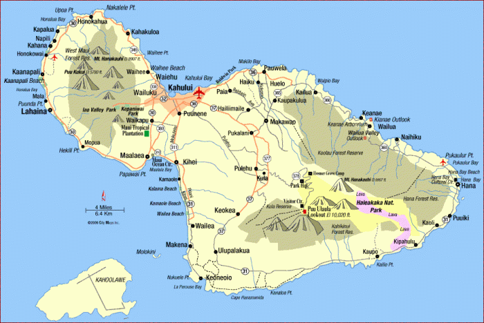
If you’re not familiar with Maui and the Hawaiian islands, here’s a little geography refresher. Maui is one of the most popular tourist destinations in the Hawaiian islands. The island has two parts– the older West Maui Mountains in the upper left and the larger and newer Haleakala portion in the lower right. West Maui is gorgeous– it is eroded and so it has deep valleys. The northeast side in particular has a Jurassic Park feel to it. The mountain there is smaller, only reaching about 5,000 feet. It’s also very steep and remote– in fact, you can’t get to the top without rugged hiking gear and special permits because it is a very delicate ecosystem. The larger Haleakala portion of the island is much larger and newer. The mountain here is gigantic– reaching over 10,000 feet above sea level. The caldera at the top of the mountain is huge– it’s said that all of Manhattan can fit easily inside of it. The mountain hasn’t erupted since 1790. There is a wide valley separating the two halves of the island (eventually in 5-10,000 years it will sink and disappear– splitting Maui into two separate islands). When most people think of visiting Maui, there are tourist epicenters in the Lahaina-Kaanapali-Kapalua region (west side of west Maui) and in the Wailea region (west side of Haleakala). The reason for this is simple– the winds on all the islands hit from the northeast, making that windward side of the island relatively wet, lush, and tropical. By contrast, the leeward side is drier, sunnier, and often like a desert. Tourists like the sun– so all the big hotels are located on the west sides of the island. The exception to this rule is the town of Hana, which is isolated at the far east end of the island. Everything is relatively easy to get to from Kahalui, which is located in the flat middle section and where the airport is located.
Maui– as well as the other Hawaiian Islands– is one of the youngest islands in a long stretched out archipelago of islands and atolls stretching over a 1,000 miles northwest to Midway Island (halfway to Japan). Some of these “islands” barely break the surface of the water and almost all of them, except the Hawaiian Islands, are uninhabited. The islands are created by a hotspot in the earth– as the large Pacific plate moves northwest over this hotspot, the lava from underneath bubbles up from the earth’s core, creating volcanoes on the ocean’s floor. In fact, measured from the point where the mountain actually begins (19,680 feet below sea level), Haleakala is actually higher than Mount Everest at a height of 29,703 feet!
Day 1 (Kihei to La Perouse Bay)
After arriving late on Thursday night, we set up our bikes and had an easy day on Friday to open up the legs and get used to riding outdoors again. We parked the vans in Kihei and rode south, past Wailea, and to the dead end of the road in Kanaloa. After a winter of riding exclusively indoors, it was both exhausting and euphoric to ride outside again!
The road down to Wailea was unbelievably windy. We had a great tailwind going out– but that made for a murderous headwind coming home. I had a bit of an advantage here– I can get really low on my road bike by riding it more like a TT bike. Plus, I really love going fast on the flats– and there is plenty of flat between Kihei and Wailea. Swooping down in Wailea, we got into some pretty rolling ground and John’s combination of tiny size and high power made him the man to chase. Up to Wailea, it was an easy ride– only about 115 watts average and 132 watts normalized (including lots of breaks). In the rolling hills around Wailea, that spiked up to about 234 watts average and 243 watts normalized.
I’ve never really been a fan of the Wailea area. It is a fairly posh area, with boutiques from companies like Gucci filling high-end shopping malls. The Fairmont Hotel is probably the biggest hotel in the area. Something about staying in a horrendously expensive hotel and shopping for Italian fine leather products doesn’t seem like my idea of Hawaii. Disturbingly, on our return leg of the ride, we hit a huge delay as a moped rider was killed outside the Fairmont shortly before we rode past the hotel. This was really eerie to all of us– a group of three people passed us leaving the turnaround point on mopeds and none of them had a helmet!
 Our goal for this tune-up day was La Perouse State Park. Going south past Wailea, the road becomes rougher as fancy hotels give way to gated communities, then smaller houses, and then undeveloped land. Eventually, it winds down to the ocean and becomes incredibly rough. My biceps ached for the rest of the day after clutching onto my shaking handlebars! By this time, both sides of the road had wide fields of what looked like very roughly-tilled soil. After riding along for a mile, my curiosity got the best of me and I stopped and picked up a smaller chunk about the size of a softball. It was fairly light and jagged, but it was definitely lava.
  I later learned that the Hawaiians called this ‘a’a lava, which was a sharp, jagged lava that typically forms in very slow moving lava flows. Apparently, as the lava oozes along, it hardens on the outside and forms jagged clumps that get shed everywhere. Then, as it continues to cool and shrink, it can continue to create more jagged rocks. It’s utterly miserable stuff– it’s difficult to walk on and, after just a few yards, my cycling cleats were really ripped up and made it had to clip in for the rest of the trip. In fact, the only animals we saw on the ‘a’a lava were families of goats, which seemed to have free run of the area.
This portion of the island was where the last eruption on Maui occurred in 1790. It’s also where the French explorer La Perouse landed in 1786. Given that the 1790 eruption added about 2,000 acres of land to the island, it must have looked quite different to La Perouse back then!
As I mentioned earlier, there was a fierce headwind heading back into Kihei. I was trying to keep my effort reasonably hard in order to leave them just a bit tired. John and I pretty much rode together but I think I was feeling a bit spunkier for the day. By the time we got back to Kihei, however, I was happy to be off my bike. The wind was just unbelievable and the warm, humid air left me a bit dehydrated. The ride back came in at about 160 watts average and 189 watts normalized– but that included a bunch of delays and stops.
Day 2 (Haleakala)
 About 15 years ago, I was not in such a great spot when I visited Maui for the first time. Back home in DC, one of my beloved shelties was going recently diagnosed with kidney disease and had only a few weeks left. I was young enough (just a little older than John is now) that I was relatively unacquainted with death. At the same time, I was experienced enough with sports to be very acquainted with time in the pain cave. I was visiting Maui after attending a friend’s wedding on Oahu and I had never heard of mountains in Hawaii. When I saw Haleakala and learned that it was possible to ride a bike to 10,000 feet from sea level, I did what any not-so-reasonable person in my position would do– figure out how to run to the top! So I dropped into Dick’s Sporting Goods, bought a long-sleeve poly sports shirt and a pair of tights and sketched out a route. I didn’t know about the route from Paia and only knew that the Haleakala Highway leading to Kahului was busy, winding, and not-so-safe stretch of road for running, so my run would start from the intersection with Crater Road (about 3,200 feet) and go 22 miles to the top. As I jogged up the mountain, I kept thinking about my sheltie back home. Living so intensely while doing something so extreme was my tribute to a life cut short too soon. I probably cried as much as I perspired.
Fifteen years later and I’m back on the mountain– this time on a bicycle. We started the ride in Paia and followed the course that Donnie at Maui Cyclery (who runs the annual Ride to the Sun bike race up Haleakala) recommended. First, we dipped our toes in the Pacific Ocean and then hopped on our bikes, riding southeast out of Paia on Baldwin Avenue.
The road from Paia is a steady gentle climb with relatively little traffic– far better than Haleakala Highway into Kahului. I was still feeling a little tired from the day before, so the gentle opening miles were much appreciated. After what seemed an eternity, we rode through the tiny upcountry town of Makawao. We took a quick break in Makawao and the mountain punished us with a steep, nasty pitch. There’s a tiny rodeo here at the intersection with Hanamu Road in the Olinda community and we were told to turn right. Maui’s upcountry is wonderful. It tends to be a little cooler (we were between 2,000 and 3,000 feet above sea level). Surf shops give way to protea gardens and grazing horses. Hanamu Road would be one of the only tiny stretches of downhill that we would get. After Hanamu Road, we turned left onto (the dreaded) Haleakala Highway that I avoided 15 years ago– but only for a very short stretch to the Kula Market (about a half mile away before Crater Road). Haleakala Highway was the busiest part of the ride but by this point, it wasn’t as bad as the lower portions. We took a quick stop behind Kula Market to eat and refill our water bottles before the next break at the Visitor Center at 7,200 feet. By this point, I was also perspiring like crazy– I was wearing a waterproof Castelli Gabba short-sleeve jersey and Claudio water-repellant shorts. My power up to this point was pretty average– about 160 watts average and 180 watts normalized.
 From here, we turned onto Crater Road and the road was painfully familiar– this is where I started my run 15 years ago. Shortly after turning onto Crater Road, we got hit with the cloudy, sometimes wet and misty weather– now, my choice of clothing was beginning to pay off. First, we rode through trees, which gave way to grassy fields. Lots and lots of switchbacks and hairpin turns.
Thinking back to my run, I remembered that running this course is a lot scarier than riding it. On foot, I try to stay on the left side of the road so I can see (and avoid) oncoming traffic; unfortunately, this makes hairpin turns scary because descending cars and cyclists tend to ride on the shoulders of the road and a crazy runner is probably the last thing that they are expecting to see coming in the other direction. So I switched to running in the same direction as traffic, which felt very unnatural and vulnerable– again, there aren’t that many runners on Haleakala.
 But there were tons of cyclists! Up to the Visitor’s Center, we kept passing groups descending the mountain. There are a number of companies that rent mountain bikes and beach cruisers for descending the mountain. You can always tell when people are part of one of these groups– they all ride together with motorcycle-style mountain bike helmets. After a bunch of accidents, the National Park Service won’t let these companies above the park entrance at 7,000 feet. Every time we saw one of these groups, we would give them a quick wave and a smile– no doubt, we each thought that the other group was nuts.
Ann decided that she didn’t want to ride today and so she drove the support van– and she did an amazing job supporting us. At each stop, she set out food and water. I breathed a huge sigh of relief each time I saw her. Riding between 4-6,000 feet, the grade pitches upwards to about 8% for several long stretches. Ann rode up beside me and said that there were blue skies just ahead. Sure enough, but with blue skies, I could see the long road in front of me and (tiny) John always just slightly out of reach. I stopped once to eat a Clif bar and then, one turn later, got stopped behind a half-dozen cars at the park entrance. After a long wait, I started going again and met John at the Visitor Center at 7,200 feet. From the Kula Market, my power was about 170 watts average and 175 watts normalized.
 After a recharge at the Visitor Center, we started our final assault on the hill. John headed out first and then Mark. I started a few minutes later, turned around quickly, put on my knee warmers, and headed out again. It’s a good thing I did turn around because right after the next hairpin turn, the clouds returned and it was a cold ride straight in to a headwind. Rounding the next hairpin, the headwind turned into a tailwind and blood would return to my fingers. It would be like this for the rest of the ride– headwinds and tailwinds. After a few turns, I caught Mark and then John, who was really tired from a short blast coming out of the Visitor’s Center. The clouds had given way to blue skies again and now I was hot and tired. We then rounded the final right hand turn and saw a sign that read, “Summit– 2 miles.”
 It’s interesting how two people (John and I) could have entirely different reactions to that simple message. John felt inspired; I felt despondent. I must have lost 50 watts of power and handed them right over to John. Frankly, had he never seen that sign and just kept his pace going, he would have dropped my like a hot rock because I was crushed as soon as I saw it. So I watched John speed away. But I also knew about something he didn’t know about– a steep kick at the end of the ride.
The “Summit– 2 miles” sign wasn’t entirely correct. It was two miles to the main visitor parking for the summit. From there, it’s about a 0.34 mile walk to the true summit– at about a 9% grade. We all had some choice words about this last little stretch of road. Pulling up to the final lot, I saw the sign for 10,000 feet and had to stop to take a photo. Whew, that was some bit of climbing for one day! My power during this last stretch of climbing stayed in the 170 watts range with some spikes.
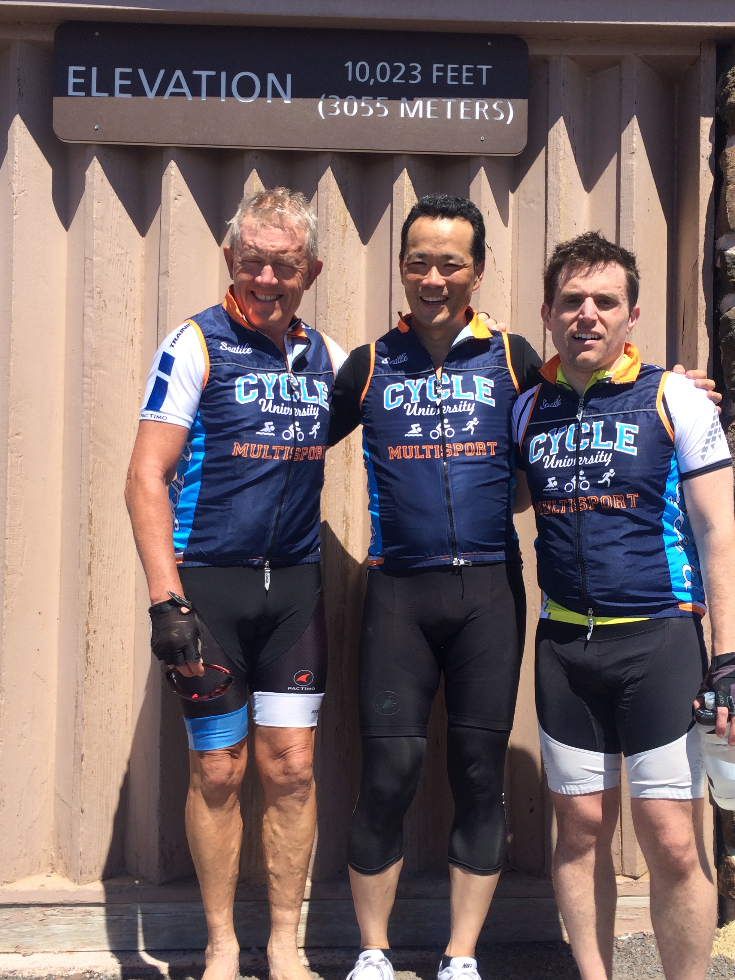 My friend Mark pulled up shortly afterwards. Mark and I have both climbed Mount Evans (14,258 feet) in Colorado twice by bike and so I was anxious to compare notes with him about the differences. Haleakala is 10,023 feet of climbing from sea level in about 34 miles whereas Mount Evans is 6,734 feet of climbing (the ride starts in Idaho Springs at 7,523 feet) in 28 miles. Haleakala is one straight climb while Mount Evans has some good long flat or downhill stretches. Both have a kick at the end– but Mount Evans is worse, going from Summit Lake at 12,830 to 14,258 feet in about 4 miles (6% average grade).
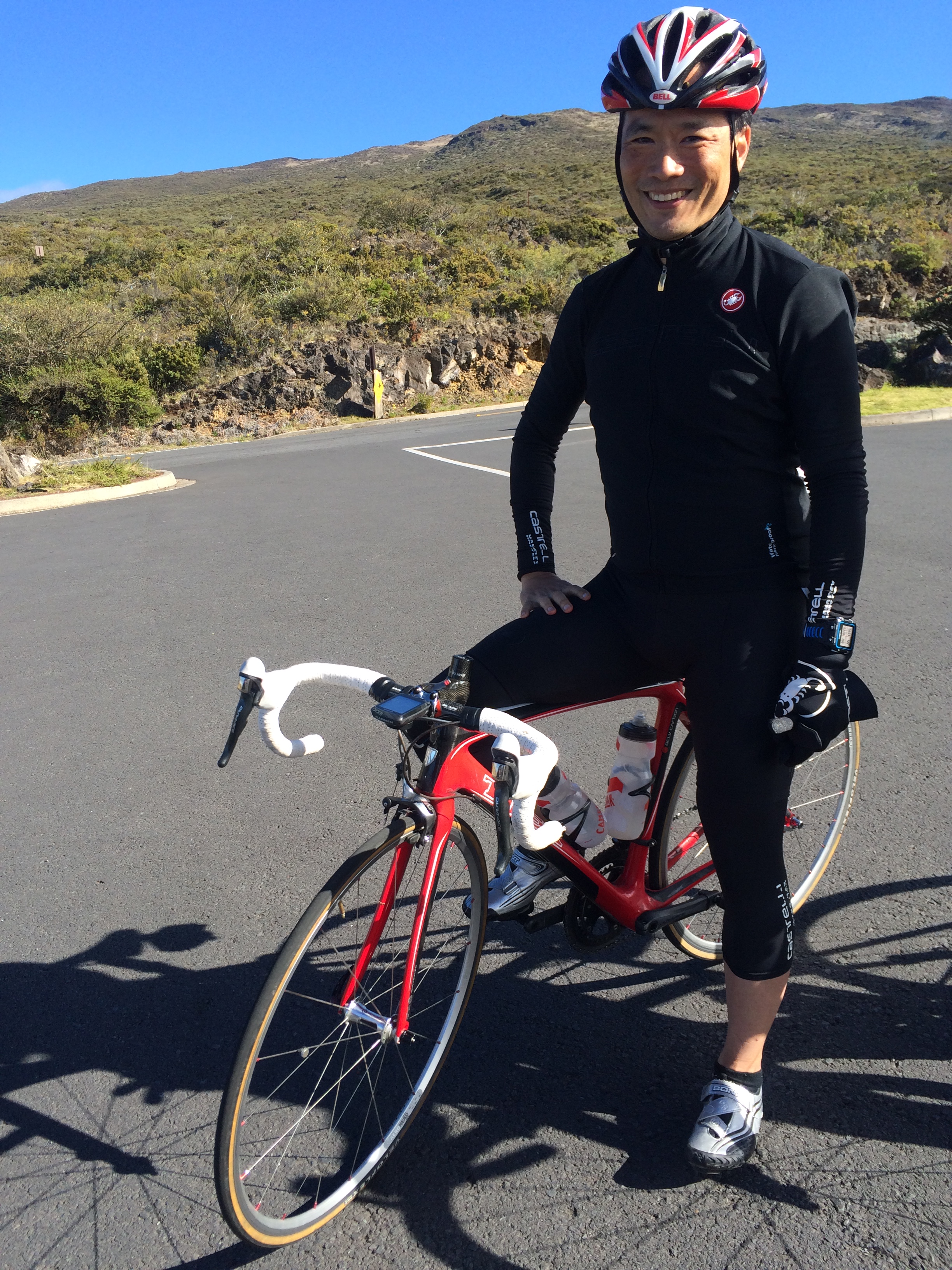
After awhile, I started getting a little chilly so I decided to ride downhill. Aileen had stopped at the Visitor Center– her IT band was bugging her and she had already ridden to the summit twice before. So I thought I would bomb the downhill and hang out with her while the others came down. So I pulled on my arm warmers and someone insisted I looked like a Belgian one day classic racer and snapped my picture. As I came down the hill, I rounded the turn with the deceitful “summit– 2 miles” sign and stopped– I saw Mary coming up the hill and offered some encouragement. While normally quite a gabby person, Mary turns utterly laconic on hard efforts. Apart from asking a quick “how many miles?” she had nothing else to say. So I continued bombing down the hill and waited with Aileen for a long time before the next group joined us. Then, I bombed down to Kula, being careful about the unmarked cattle guards on the ride down. Another quick recharge and drop off of arm warmers and knee warmers (it was getting hot) and I sped down to the house. Overall, a nice easy ride of only 348 TSS points.
 After the ride, Elly and I took a short run along the sea shore going east from Paia. We were staying next to Mama’s Fish House and so we were running along the Hana Highway. Less than a mile east of Mama’s is Lo’okipa State Park on the oceanside of the highway, which we ran through. As we were running, we noticed a large group of tourists on the east side of the beach, just as the road goes up to the picnic area. We went to the water to explore and saw about a dozen sea turtles on the beach. If you visit by car or bike, you have to enter on the far eastern end– the sea turtles will be on the right, just as the road goes downhill.
  The photos I took here are from the next day– and there are only two turtles on the beach. As the sign indicates, the turtles come here as a “resting spot” to sun themselves after swimming in the ocean. Back in Seattle, my wife Laura and I go to the Japanese Garden on sunny days and love seeing the tiny box turtles crawl on to the rocks to sun themselves. It seems that sea turtles like to do exactly the same thing. And like their tiny freshwater cousins, sea turtles are comparably awkward crawling along the beach.
Day 3 (West Maui Mountains)
The last time I was in Maui, I also had my bike. We were staying a few days in Kaanapali area so I rode the West Maui Mountains…. a lot. So today we started out from the Aquarium and, with an unbelievable tailwind, rode up towards Lahaina. I really love this stretch of arid road as it has grand vistas towards Lanai and Kahoolawe. After a quick downhill, it was a long flat march to Lahaina. Here, Mark had the real advantage as he brought his time trial bike to Hawaii and our tailwind was quickly beginning to reverse itself. We rode easily through Lahaina and spotted a whale or two from the wharf. From here, we rode to Kapalua, where we rested for a few minutes and filled our water bottles. For this stretch, I was holding about 160 watts average and 180 watts normalized.
North of Kapalua is where the fun begins, however. Kapalua is all golf courses and beautifully manicured lawns. It has a very Republican feel to it. This would all change very rapidly. The busy highway that we were on would become a quiet two-lane road– and ultimate a one-lane road. Since my last trip, the roads have improved 100%– the last time, it was full of mud and bare earth stretches. This time, at least there was pavement.  Nevertheless, the road is so narrow for much of it that, if you meet a car coming from the other direction, one of you is going to back up all the way up or down the hill. In fact, it’s even tight on a bicycle with a car coming in the other direction– there were plenty of places where we had to stop and press ourselves against the rock to enable the car to get past.
But the reward for this difficulty is isolation– and a return to back country Maui. Frankly, this is the best part of Maui– and I hope it never becomes like Kapalua. Back here, feral chickens and cats fill the forests (sadly, these are both non-indigenous and– as cute as they are– they are killing off the native species).
 During my last trip, I discovered a particular nasty hill that locals call, “the wall.” I sent this picture out to my friends with a protractor showing the grade as 27%. Of course, that’s an optical illusion– the hill recedes in the distance. The actual grade is only about a 15% for a quarter mile– although some people say 14% and some say 20%. There were a few steep climbs before it and afterwards, but nothing compared to this hill. When I hit the bottom, I could feel my speed disappear. I shifted in to my lowest gear and just started pushing. After only a few yards, I knew I was in trouble. I was exhausted from the climb the day before. I didn’t want to stand, because I was riding so slowly that my center of gravity would be too high and I might just tip over. But I also couldn’t stop because I’d never be able to start again. So that left me to sit down and inch my way to the top. John, of course, sailed up the hill and later said that he held about 400 watts going up the hill. Ah, the joys of youth– I could barely hold 260 watts on my tired old-guy legs. In case you want to seek out (or avoid) this beast of a hill, it’s a bit hard to locate because there aren’t any real landmarks near it. It’s located at the bottom of Honokohau stream. Another way to locate it is to drive 5-1/2 miles north from the turn off to Kapalua.
 After The Wall, we rested a moment to shake off that painful memory. Then, we kept riding until we intercepted part of our team heading in the opposite direction. This was shortly before Kahakuloa– where the rocky outcropping at the beginning of this blog post is located. Right before Kahakuloa, the road turned into a single-lane road. Riding into Kahakuloa, most of the folks we saw were native Hawaiian families. More chickens and cats were everywhere and cars only came by every few minutes. One of the places to visit back here is Julia’s Banana Bread, which is some pretty amazing banana bread. Actually, I’ve not had too many bad loaves of banana bread– and it always tastes great during a long ride– so I can’t really say whether it was remarkably better than any other banana breads I’ve tasted. But it sure did taste good then.
Honestly, after Kahakuloa, the climbs seemed to lose their punch– or maybe there was some ergogenic components in that banana bread. The climbs were still hard— but not as bad as the first part of the ride. About ten miles later, we were back in the car and riding back home. Only 220 TSS points for the day but I was shelled.
I went for another run– this time shooting for about six miles. After about 2-1/2 miles, I felt this sudden wave of dizziness come over me and I had to sit down for a few minutes and then walk slowly back for about 15 minutes. Turned into a very slow 5-mile run instead of a moderate 6-mile run. In the evening, our friends Mark and Heather Leach from Seattle joined us for an awesome dinner. Mark Dawson and Mary also know Mark and Heather– we’re all friends from doing USAT and ITU duathlon events.
Day 4 (Hana)
 This was our last day in Maui and we planned to make the best of it. Mark was leaving for Honolulu at around 4pm and take a morning flight back to Adelaide. Mary, Elly, John, and I were flying out around 10pm on the redeye back home. We decided to drive to Twin Falls (just before mile marker 5) and ride as far as safely could before turning around. John, Elly, and I rode together to around Wailua before turning around at 1:45 into the ride. We didn’t even make it fully to the top of the hill– at 1:45, I said I was done and wanted to turn around. Frankly, after riding and running for the last several days, I was shelled.
 Aileen had warned us that the ride to Hana had hills comparable to the West Maui loop so I wasn’t really that thrilled about another day of nasty hill climbing. As it turned out, the road to Hana is much gentler than the West Maui loop. While the hills are much, much longer (the longest was over 3-1/2 miles long), they also aren’t as ridiculously steep as the West Maui loop– and there certainly isn’t anything to compare with “the wall” on the road to Hana. Most of the ride is over well-paved two-lane roads and it’s easy to get some real speed going on the descents.
But, again, I was shelled. I was shelled when I started this ride. I was shelled when 1:45 came up on my stopwatch. I could see a bridge (the one in the picture) and so I told myself I’d ride there and wait in case Elly and John wanted to keep going. Not me. I would just sit on this bridge and stare at the beauty around me, which really was quite stunning. The road to Hana is on the windward side of the island so it gets lots of rainfall. The forest grows lush and thick here– and there are hundreds of beautiful waterfalls. I had been riding relatively well– about 170 watts normalized with all the ups, downs, and waiting and about 180-190 watts on the last long ascent.
 When I said I was turning around, Elly and John readily agreed. We got a tourist to snap a picture of us around the turnaround point. I think I was holding up my left arm against a post so I wouldn’t fall over. Not my best pose, but I’ve got at least a dozen year on Elly and 18 years on John. When you get as old as me, you stop caring what you look like.
On the ride back, I just couldn’t wait to get to the car, so I started pushing things a bit. Before the ride, we agreed that we’d get smoothies as a treat where we parked our cars– and this offer was a carrot dangling in front of me the whole ride back. We intercepted Aileen on the ride back as she was pulling out from a rest stop but, instead of staying with her, we stopped, gulped down some soda, water, and a shaved iced. Nevertheless, I really wanted off my bike, so I rode a bit harder still. I held about 220 watts coming up the last long hill and about 190 watts (including downhills and stops) until we got home. I somehow avoided the temptation to throw my bike in a ravine when I stopped.
After the ride, we packed and shuttled Mark off to the airport. Then it was a haphazard “dinner-on-your-own” night before we packed up the cars and drove to the airport. Mary and I somehow got the only two upgrade slots on the flight back. TSA had to hand-inspect our bike bags because the x-ray machine wasn’t large enough to accommodate our bags. Then, when we got to security, the lines were ridiculously long. I had TSA PreCheck (where there was no line) and I was already sitting in my seat on the plane before my friends even cleared security. I can’t say that I remembered much about that flight back– I was out like a light.
Wrapping Up
For me, the highlight of any trip to Maui is Haleakala. The first time I did it on foot was certainly harder but no less memorable. Looking back, I think it was a great idea to have a non-competitive but grueling athletic event planned for mid-winter. Apart from making the winter pass faster, it also gives an immediate goal for the winter training and also creates a sharp fitness spike. Alaska Airlines makes it super-easy with their $99 companion tickets.
I’m already planning the next “big” trip– probably a haul up Mauna Kea on the Big Island. This might attract a a nutty group of friends who are dead set on killing themselves on a climb that many describe as the hardest bike climb in the world.
Thanks for reading and be sure to like the Athletic Time Machine Facebook page and follow us on Twitter @AthTimeMachine. If you found this post useful, please reblog it on WordPress, share it on Facebook, or retweet it on Twitter to share it with your friends.
